Ȟaȟá Wakpádaŋ (Bassett Creek)

Bibliography
Anfinson, John. River of History: A Historic Resources Study of the Mississippi National River and Recreation Area. National Park Service, 2003.
https://www.nps.gov/miss/learn/historyculture/historic_resources.htm
Anfinson, Scott F. “Archaeology of the Central Minneapolis Riverfront.” Minnesota Archaeologist 48, nos. 1–2 (1989).
https://www.fromsitetostory.org/sources/papers/mnarch48/48inv-bc.asp
Bassett Creek Flood Control Commission. Watershed Management Plan for Bassett Creek; prepared for the Bassett Creek Flood Control Commission and Member Communities. Barr Engineering Company, 1972. Available at the Minnesota Historical Society library as TC424.M6 B372 1972.
https://mnpals-mhs.primo.exlibrisgroup.com/permalink/01MNPALS_MHS/ge68j0/alma990015947740104294
Bassett Creek Flood Control Commission records, 1976–1979
State Archives, Minnesota Historical Society, St. Paul
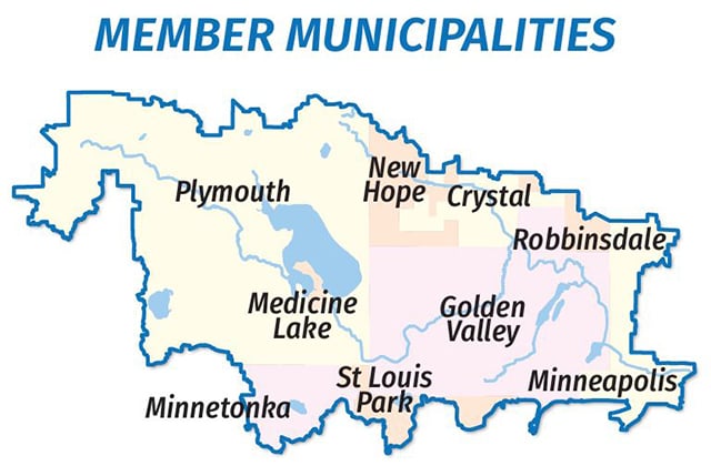
Description: Records of the Bassett Creek Flood Control Commission, formed in 1969 under a Joint Powers Agreement of the Hennepin County municipalities of Crystal, Golden Valley, Medicine Lake, Minneapolis, Minnetonka, New Hope, Plymouth, Robbinsdale, and St. Louis Park, to provide for cooperation in the investigation, planning, and implementation of flood control measures in the Bassett Creek watershed.
https://storage.googleapis.com/mnhs-finding-aids-public/library/findaids/bcfccomm.pdf
Bassett Creek Watershed Management Commission. "About Main Stem Bassett Creek."
https://www.bassettcreekwmo.org/lakes-streams/main-stem-bassett-creek
——— . "BCWMC Flood Control Project and Tunnel."
https://www.bassettcreekwmo.org/application/files/6914/4424/7362/FloodControlProjectandTunnel.pdf
——— . "BCWMC’s History."
https://www.bassettcreekwmo.org/about/our-history
——— . "Creek Co-naming Practices."
https://mail.bassettcreekwmo.org/application/files/5117/3706/7903/Equity_Related_Policies_and_Practices.pdf
——— . "Fiftieth Anniversary, 1969–2019 [brochure]."
https://www.bassettcreekwmo.org/application/files/2215/6201/7207/BCWMC_50th_Brochure_for_web.pdf
——— . "Ȟaȟá Wakpádaŋ & Indigenous Culture."
https://www.bassettcreekwmo.org/haha-wakpadan-indigenous-culture
——— . “Ȟaȟá Wakpádaŋ / Bassett Creek Watershed.”
https://www.bassettcreekwmo.org/application/files/3217/5260/4766/Watershed_map_1-21-25_not_password_protected.pdf
——— . “Secrets of the Bassett Creek Watershed.”
https://www.bassettcreekwmo.org/application/files/1816/1823/7519/BCWMC_Back_of_Map.pdf
Joel B. Bassett papers, 1859–1876 (bulk 1865–1868)
Manuscripts Collection, Minnesota Historical Society, St. Paul.
Description: Correspondence, reports, treaty drafts, payment vouchers, applications for Indian trader licenses, and similar documents relating mostly to Bassett's work while agent at the Chippewa Agency, Crow Wing, Minnesota (1865–1869).
“Bassett’s Creek.” Black and white photograph, 1935. Minneapolis Newspaper Photograph Collection, Hennepin County Library Digital Collections (P43830).
https://digitalcollections.hclib.org/digital/collection/MplsPhotos/id/42209/rec/62
“Bassett’s Creek Improvement, Minneapolis.” Black and white photograph, August 26, 1936. Minnesota Historical Society Collections (MH5.9 MP4.1 r266).
https://www.mnhs.org/collection-record?uuid=b1aedb50-1460-4935-af47-d67d1235856b
“Bassett’s Creek in the Vicinity of Chestnut and Upton, Minneapolis.” Black and white photograph, ca. 1935. Minnesota Historical Society Collections, (MH5.9 MP4.1 r123).
https://www.mnhs.org/collection-record?uuid=26594e98-6b94-4cb3-bb08-c8c21fa69cfc
Bendickson, Joe (Šišóka Dúta). Personal correspondence with the author, November 19, 2025.
Berg, Virginia. “Grandson of First Settler Tells of Early Days in Area.” North Hennepin Post, November 15, 1951. Available at the Golden Valley Historical Society archives (A0448_a). MN Collections.
https://mncollections.org/Detail/objects/499211
Biber, Josh. “The History of a Hidden, Toxic Creek That Still Flows Below North Loop.” Racket, August 3, 2022.
https://racketmn.com/bassett-creek-minneapolis-north-loop-history
Blomfield, Edward A., ed. “The Laycock’s [sic], Pioneers of St. Louis Park.” Hennepin County History: A Quarterly Bulletin 5, no. 19 (July 1945): 5.
https://digitalcollections.hclib.org/digital/collection/p17208coll13/id/566/rec/2
Borchert, Jane, et al. “Golden Valley Trails of Yesteryear.” Trail map, 1962. Available at the Golden Valley Historical Society archives (A0288). MN Collections.
https://mncollections.org/Detail/objects/409008
Bray, Martha C., ed. The Journals of Joseph N. Nicollet: A Scientist on the Mississippi Headwaters, With Notes on Indian Life, 1836–37. Minnesota Historical Society, 1970.
https://archive.org/details/journalsofjoseph0000nico/page/226/mode/2up
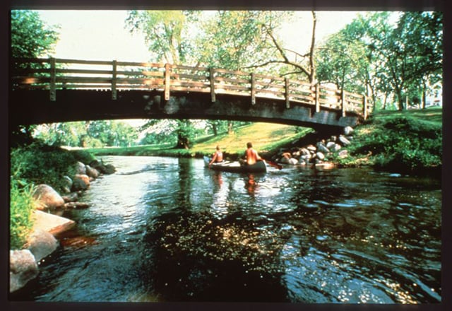
“Canoe Recreation on Bassett’s Creek, Minneapolis, Minnesota.” Color photograph, 1988. Minneapolis Park and Recreation Board, Minnesota Digital Library (umn378299).
https://collection.mndigital.org/catalog/p16022coll55:2534#?xywh=-363%2C-1%2C6283%2C3822
City of Crystal. “Appendix H: Local Surface Water Management Plan.” Section 3.3, 16, 2018.
https://cdnsm5-hosted.civiclive.com/UserFiles/Servers/Server_10879634/File/Resident/Community%20Development/LocalSurfaceWaterPlan.pdf
City of Minneapolis. “Water Resource Management Plan, October 2018.”.
https://minneapolis2040.com/media/1445/minneapolis2040-appendix-f_12_19_18.pdf
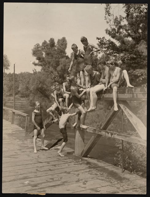
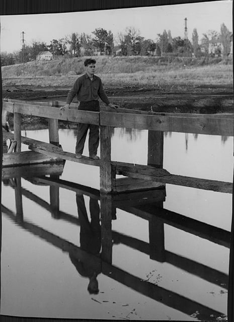
Cloud, Paul Weir. “Boys on Swimming Party Posed on Bridge Over Bassett’s Creek.” Black and white photograph, ca. 1920. Minnesota Historical Society Collections (GV3.62 p62).
https://www.mnhs.org/collection-record?uuid=2e6d20e6-00ff-4c7f-be50-7253ceb764be
Cornejo, Dan. “Daylighting Creeks in Hennepin County: Recommended Locations for Feasibility Study.” Cornejo Consulting, 2006. Prepared for Hennepin County Department of Housing, Community Works, and Transit.
http://finog.org/bridal_veil/docs/daylighting.pdf
DeCarlo, Peter. “Lines on the Land: How Dakota Homeland Became Private Property; A History of the South Loop District to 1900.” Prepared for the City of Bloomington Creative Placemaking in the South Loop Board of Commissioners, August 29, 2021.
https://www.bloomingtonmn.gov/sites/default/files/2023-03/South%20Loop%20History%20Report_Creative%20Placemaking.pdf
Durand, Paul. Where the Waters Gather and the Rivers Meet: An Atlas of the Eastern Sioux. Paul Durand, 1994.
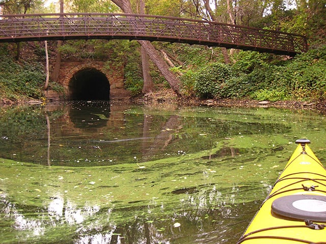
edkohler. “Bassett Creek Outlet to the Mississippi River, September 2008.” Color photograph, September 28, 2008. Wikimedia Commons.
https://commons.wikimedia.org/wiki/File:Bassett_Creek_outlet_to_the_Mississippi_River,_September_2008.jpg
Folwell, William Watts. “The Sale of Fort Snelling, 1857.” Minnesota Historical Collections, vol. XV (1915): 397.
https://archive.org/details/saleoffortsnelli00folwrich/page/396/mode/2up
Frémont, John Charles, J. N. Nicollet, and William James Stone. “Hydrographical Basin of the Upper Mississippi River from Astronomical and Barometrical Observations, Surveys, and Information,” 1843. Geography and Map Division, Library of Congress.
https://www.loc.gov/item/78692260
Friends of Bassett Creek. “A Brief Description and History of Bassett Creek.” May 10, 2003. Saved by the Internet Archive Wayback Machine, October 6, 2024.
https://web.archive.org/web/20241006194034/http://www.mninter.net/~stack/bassett/descript.htm
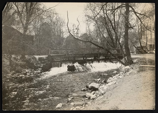
“Fruen Mill Dam on Bassett’s Creek, Minneapolis.” Black and white photograph, 1908. Minnesota Historical Society Collections (MH5.9 MP4.1 r142).
https://www.mnhs.org/collection-record?uuid=78323648-cef6-4410-9051-e574b6cf08b9
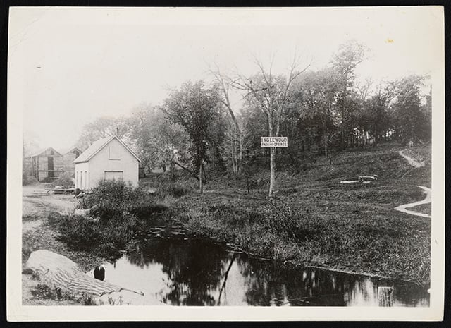
“Glenwood-Inglewood Spring and Ice House Near Bassett’s Creek, Minneapolis.” Black and white photograph, ca. 1894. Minnesota Historical Society Collections (MH5.9 MP4.1 r141).
https://www.mnhs.org/collection-record?uuid=722f9570-1d68-4765-a23c-9516a2855c93
Goetz, Edward G. Hollman v. Cisneros: Deconcentrating Poverty in Minneapolis. Reports 1–8. University of Minnesota Center for Urban and Regional Affairs, 2002.
https://www.housinglink.org/files/hollman-compilation.pdf
Golden Valley Historical Society. Golden Valley: A History of a Minnesota City, 1886–1986. Golden Valley Historical Society, 1986.
Gustafson, Neil C. “Bassett’s Creek: A Case Study on the Changing Concepts in Urban Land Use.” Diss., 1959. Available at the Minnesota Historical Society library as F613 .M68B3 .G8.
https://mnpals-mhs.primo.exlibrisgroup.com/permalink/01MNPALS_MHS/ge68j0/alma990016456960104294
“Ȟaȟa Wakpádaŋ / Bassett Creek Oral History Project.” Interviews by Dr. Kasey Keeler, 2022. MN Collections.
https://mncollections.org/Gallery/3964
Hamilton, William J. “Old North Minneapolis: Below Plymouth and Lyndale Avenues.” Hennepin County History 17, no. 4 (Winter 1958): 17–18.
https://digitalcollections.hclib.org/digital/collection/p17208coll13/id/4906
Haugen, Emily. “Golden Valley Holds First Annual Indigenous Peoples’ Day Water Ceremony.” CCX Media, October 9, 2023.
https://ccxmedia.org/news/golden-valley-holds-first-annual-indigenous-peoples-day-water-ceremony/
Herbert, Jim. Personal correspondence with the author, October 29, 2025.
Hoisington Koegler Group, Inc. “Bassett Creek Valley Master Plan.” Redevelopment Oversight Committee, 2007.
https://minneapolis2040.com/media/1502/bassett-creek-valley-master-plan.pdf
“In a Normal Condition.” St. Paul Daily Globe, July 30, 1892.
https://newspapers.mnhs.org/jsp/PsImageViewer.jsp?doc_id=ccbd77b2-b2c5-425f-8a1f-675f2576f46e%2Fmnhi0031%2F1HMADE59%2F92073001
Jarrett, J. J. “Subdivision of Township No. 29 North, of Range 24 West of 4th Principal Meridian, Minnesota.” U.S. Department of the Interior Bureau of Land Management, vol. I4166 (1853): M250.
https://glorecords.blm.gov/details/fieldnote/default.aspx?dm_id=232136&s_dm_id=94151&sid=wem2tzis.uxs
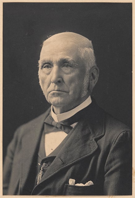
“Joel B. Bassett.” Black and white photograph, ca. 1890. Minnesota Historical Society Collections (por 16635 p1).
https://www.mnhs.org/collection-record?uuid=0be72a68-cd2d-4f85-849a-52fa2b3cca1b
Keeler, Kasey. “Beyond the White Picket Fence: American Indians, Suburbanization, and Homeownership.” American Indian Culture and Research Journal 47, no. 2 (2024): 97–115.
https://escholarship.org/uc/item/4417z1s0
Lowell, Anne Kessen. McCormack Baron, 1973–2023: A Legacy of Community Partnership, Housing Innovation, and Reinvestment in America’s Urban Neighborhoods. McCormack Baron, 2023.
https://www.mccormackbaron.com/assets/files/McCormackBaron_1973-2023.pdf
Maynard, Meleah. “Crippled Creek.” City Pages, November 29, 2000.
https://web.archive.org/web/20160517092501/http://www.citypages.com/news/crippled-creek-6705363
Metropolitan Council. “Comprehensive Water Quality Assessment of Select Metropolitan Area Streams: Bassett Creek.” Metropolitan Council, 2014.
https://metrocouncil.org/METC/files/8e/8e6dde4f-223a-407c-85cf-99728c1ea4a0.pdf
Meyer, Gary N. Geology of the Bassett Valley Area (Minneapolis). Minnesota Geological Survey, 1996.
https://conservancy.umn.edu/items/3cc75845-5c06-4cb9-9c2f-f989cc1a0934
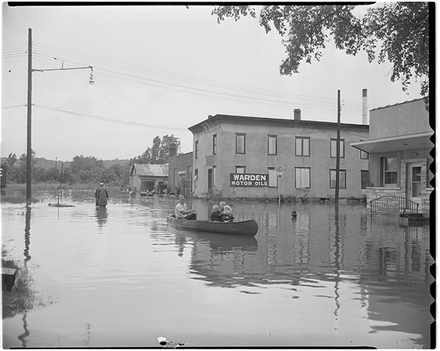
Minneapolis Star Journal Tribune. “Flood Scenes in Bassett Creek Area North of the Parade Grounds, Minneapolis.” Black and white photograph, ca. June 27, 1953. Minnesota Historical Society Collections (QC2.2d p43).
https://www.mnhs.org/collection-record?uuid=5d337798-befa-4e72-aac4-d79c09574c56
Minnesota Indian Affairs Council. “1851 Dakota Land Cession Treaties.” Treaties Matter
https://treatiesmatter.org/treaties/land/1851-dakota
Minnesota Pollution Control Agency. “Minneapolis | Former Precision Plating Superfund Site.” December 26, 2024.
https://www.pca.state.mn.us/local-sites-and-projects/minneapolis-former-precision-plating-superfund-site
Mississippi Watershed Management Organization. “Old Bassett Creek Tunnel.”
https://www.mwmo.org/projects/old-bassett-creek-tunnel
Morris, Lucy L. W., ed. Old Rail Fence Corners: Frontier Tales Told by Minnesota Pioneers. Minnesota Historical Society Press, 1976.
Moser, Bert. Early Days in Golden Valley: Transcript of a Talk by Bert Moser, November 8, 1951 before Oak Grove P.T.A. Manuscript, 1951. Available at the Golden Valley Historical Society archives (A0366_a). MN Collections.
https://mncollections.org/Detail/objects/499212
Museology. Golden Valley Historical Society Permanent Exhibition Research Report. 2014. Available at the Golden Valley Historical Society archives.
Mustful, Colin. “Lake Calhoun or Bde Maka Ska?” May 6, 2019.
https://www.colinmustful.com/lake-calhoun-or-bde-maka-ska
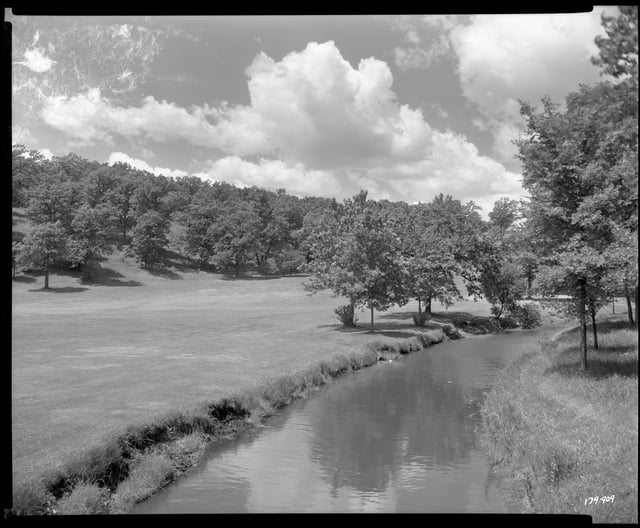
Norton & Peel. “View of Bassett Creek and the End of the Golf Course at Theodore Wirth Park.” Black and white photograph, June 7, 1948. Minnesota Historical Society Collections (NP 179909).
https://www.mnhs.org/collection-record?uuid=4d487aaa-1f65-4678-b361-e2171ee00a8d
O’Brien, Frank G. Minnesota Pioneer Sketches; from the Personal Recollections and Observations of a Pioneer Resident. Housekeeper Press, 1904.
https://tile.loc.gov/storage-services/service/gdc/lhbum/01848/01848.pdf
“On a Big Rampage: Bassett’s Creek on a High Old Tear.” Minneapolis Tribune, July 29, 1892.
https://newspapers.mnhs.org/jsp/PsImageViewer.jsp?doc_id=4a0c6900-28ec-40e6-bafa-8705a70f68f8%2Fmnhi0005%2F1DFC5F59%2F92072901
Perron, Tara (Tanaǧidaŋ To Wiŋ). Personal correspondence with the author, March 29, 2024.
Pistono, Deanna. “Preserving Native History Through Oral Storytelling.” MinnPost, July 3, 2024.
https://www.minnpost.com/greater-minnesota/2024/07/preserving-native-history-through-oral-storytelling
Pond, S. W., Jr. Two Volunteer Missionaries Among the Dakotas: or, The Story of the Labors of Samuel W. and Gideon H. Pond. Boston, ca. 1893.
https://archive.org/details/twovolunteers00pondrich/page/46/mode/2up
Rao, Maya. “‘Bless This Water’: Indigenous Peoples’ Day Ceremony Honors Creek in Golden Valley.” Minneapolis Star Tribune, October 9, 2023.
https://www.startribune.com/indigenous-peoples-day-ceremony-celebrates-waterways-haha-wakpadan-bassett-creek/600310938
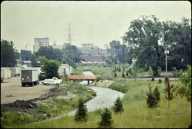
Richard Haag Associates. “Bassett Creek.” Color photograph, 1990s. Minneapolis Neighborhood Association Photographs Collection, Hennepin County Library Digital Collections (CLPA_0216). https://digitalcollections.hclib.org/digital/collection/MplsNAs/id/2244/rec/44
Smith, David C. “The Myth of Bassett’s Creek.” Minneapolis Park History, November 27, 2011.
https://minneapolisparkhistory.com/2011/11/27/the-myth-of-bassetts-creek
Smith, E. Kirby. “Map of a Proposed Reservation at Fort Snelling,” 1839. Gale Family Library, Minnesota Historical Society, St. Paul.
https://www2.mnhs.org/library/findaids/00844/00844.htm
Sommer, Barbara W., and Mary Kay Quinlan. “Ȟaȟá Wakpádaŋ / Bassett Creek Oral History Project.” In The Oral History Manual 58, American Association for State and Local History, 2024.
https://www.aaslh.org/updated-aaslh-book-the-oral-history-manual
Soper, E. K. “The Buried Rock Surface and Pre-Glacial River Valleys of Minneapolis and Vicinity.” Journal of Geology 23, no. 5 (1915): 444–60.
https://www.journals.uchicago.edu/doi/pdf/10.1086/622258
Stevens, John H. Personal Recollections of Minnesota and its People, and Early History of Minneapolis. Tribune Job Printing, 1890.
https://archive.org/details/personalrecollec00stev_0/page/n37/mode/2up?q=creek
“Storm Particulars: Further Information as to What the Rain Did.” St. Paul Daily Globe, July 28, 1892.
https://newspapers.mnhs.org/jsp/PsImageViewer.jsp?doc_id=ccbd77b2-b2c5-425f-8a1f-675f2576f46e%2Fmnhi0031%2F1HMADE59%2F92072801
“The Flood: The Damage Will Probably Amount to $20,000.” St. Paul Daily Globe, July 29, 1892.
https://newspapers.mnhs.org/jsp/PsImageViewer.jsp?doc_id=ccbd77b2-b2c5-425f-8a1f-675f2576f46e%2Fmnhi0031%2F1HMADE59%2F92072901
Thompson, James L. “Map of the Fort Snelling Military Reservation / as Surveyed by Lieut. James L. Thompson in October and November, 1839.”
https://www.mnhs.org/collection-record?uuid=364a8d92-e286-49fb-8d2c-09f513396f63
Urban Institute: Housing and Communities. Baseline Assessment of Public Housing Desegregation Cases: Case Studies—Volume 2. 2000.
https://www.huduser.gov/portal/sites/default/files/pdf/baseline2.pdf
US Army Corps of Engineers. Bassett Creek Watershed, Hennepin County, Minnesota, Feasibility Report for Flood Control, Appendices. AD–A119394. US Army Engineer District, St. Paul, 1976.
https://apps.dtic.mil/sti/tr/pdf/ADA119394.pdf
US Army Corps of Engineers. St. Paul District. Final Environmental Impact Statement, Flood Control, Bassett Creek Watershed, Hennepin County, Minnesota. US Army Corps of Engineers, St. Paul District, 1977.
https://mnpals-mhs.primo.exlibrisgroup.com/permalink/01MNPALS_MHS/ge68j0/alma990016073410104294
US Congress. House. Removals and Appointments in the Interior Department. Message from the President of the United States, in answer to a resolution of the House of February 11, relative to removals and appointments in the Interior Department. H.R. Exec. Doc. No. 113. 39th Cong., 2nd sess. (1867). https://www.govinfo.gov/content/pkg/SERIALSET-01293_00_00-038-0113-0000/pdf/SERIALSET-01293_00_00-038-0113-0000.pdf
Valley Community Presbyterian Church. “Land Acknowledgment.”
https://valleychurch.net/land-acknowledgement
“Village Charter Amendment.” Mankato Weekly Record, March 16, 1867.
https://newspapers.mnhs.org/jsp/PsImageViewer.jsp?doc_id=1d183e1e-6d95-40f7-a7f0-08c07dc8c68a%2Fmnhi0031%2F1H1BED56%2F67031601
Warner, George E., and Rev. Edward Duffield Neill. History of Hennepin County and the City of Minneapolis: Including the Explorers and Pioneers of Minnesota, by Rev. Edward D. Neill, and Outlines of the History of Minnesota, by J. Fletcher Williams. North Star Publishing, 1881.
https://archive.org/details/cu31924006600484/page/374/mode/2up
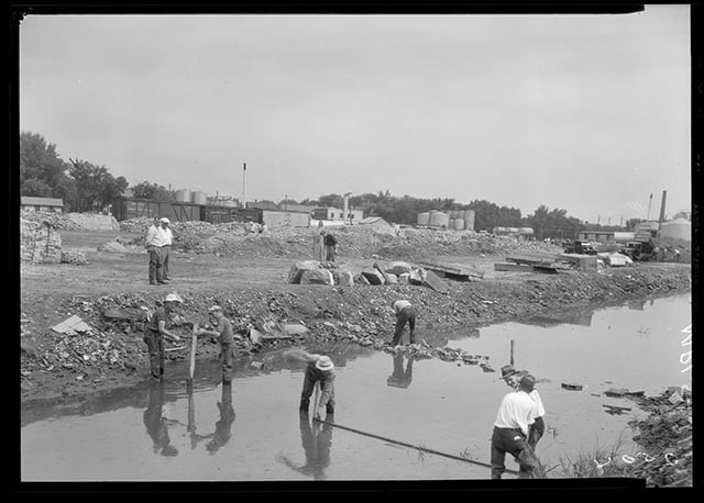
“WPA Workers at Bassett’s Creek.” Black and white photograph, 1935. Minneapolis Newspaper Photograph Collection, Hennepin County Library Digital Collections (P12174).
https://digitalcollections.hclib.org/digital/collection/MplsPhotos/id/12885/rec/61
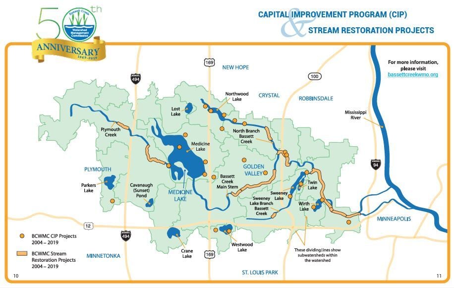
WSB Associates, Inc. “Feasibility Study: DRAFT 2015 Bassett Creek Main Stem Restoration Project.” Prepared for the City of Golden Valley, 2014.
https://www.bassettcreekwmo.org/application/files/9414/4693/2398/FeasibilityReport-2015MainStemRestoration-2015CIP-GV-18June2015Mtg.pdf
Wuolu, Anja. “Water Ceremony Celebrates Local Watershed: Native American Podcast Culminates with Water Ceremony on Indigenous Peoples’ Day.” Sun Post, October 18, 2023.
https://www.hometownsource.com/sun_post/news/local/water-ceremony-celebrates-local-watershed/article_e23f88b0-6c2f-11ee-a401-83f3fceb0fcd.html
Wurzer, Cathy, and Leah Lemm. “Bassett Creek Oral History Project Will Be First Gathering of Suburban Indigenous Stories in US.” Minnesota Public Radio News, June 24, 2024.
https://www.mprnews.org/episode/2024/06/24/bassett-creek-oral-history-project-will-be-first-suburban-indigenous-stories-in-us
Related Images


Chronology
15,000 years before present
1835
1851
1866
1923
1969
1972
1976
1992
1995
2000
2006
2021
2023
2024
Bibliography
Anfinson, John. River of History: A Historic Resources Study of the Mississippi National River and Recreation Area. National Park Service, 2003.
https://www.nps.gov/miss/learn/historyculture/historic_resources.htm
Anfinson, Scott F. “Archaeology of the Central Minneapolis Riverfront.” Minnesota Archaeologist 48, nos. 1–2 (1989).
https://www.fromsitetostory.org/sources/papers/mnarch48/48inv-bc.asp
Bassett Creek Flood Control Commission. Watershed Management Plan for Bassett Creek; prepared for the Bassett Creek Flood Control Commission and Member Communities. Barr Engineering Company, 1972. Available at the Minnesota Historical Society library as TC424.M6 B372 1972.
https://mnpals-mhs.primo.exlibrisgroup.com/permalink/01MNPALS_MHS/ge68j0/alma990015947740104294
Bassett Creek Flood Control Commission records, 1976–1979
State Archives, Minnesota Historical Society, St. Paul
Description: Records of the Bassett Creek Flood Control Commission, formed in 1969 under a Joint Powers Agreement of the Hennepin County municipalities of Crystal, Golden Valley, Medicine Lake, Minneapolis, Minnetonka, New Hope, Plymouth, Robbinsdale, and St. Louis Park, to provide for cooperation in the investigation, planning, and implementation of flood control measures in the Bassett Creek watershed.
https://storage.googleapis.com/mnhs-finding-aids-public/library/findaids/bcfccomm.pdf
Bassett Creek Watershed Management Commission. "About Main Stem Bassett Creek."
https://www.bassettcreekwmo.org/lakes-streams/main-stem-bassett-creek
——— . "BCWMC Flood Control Project and Tunnel."
https://www.bassettcreekwmo.org/application/files/6914/4424/7362/FloodControlProjectandTunnel.pdf
——— . "BCWMC’s History."
https://www.bassettcreekwmo.org/about/our-history
——— . "Creek Co-naming Practices."
https://mail.bassettcreekwmo.org/application/files/5117/3706/7903/Equity_Related_Policies_and_Practices.pdf
——— . "Fiftieth Anniversary, 1969–2019 [brochure]."
https://www.bassettcreekwmo.org/application/files/2215/6201/7207/BCWMC_50th_Brochure_for_web.pdf
——— . "Ȟaȟá Wakpádaŋ & Indigenous Culture."
https://www.bassettcreekwmo.org/haha-wakpadan-indigenous-culture
——— . “Ȟaȟá Wakpádaŋ / Bassett Creek Watershed.”
https://www.bassettcreekwmo.org/application/files/3217/5260/4766/Watershed_map_1-21-25_not_password_protected.pdf
——— . “Secrets of the Bassett Creek Watershed.”
https://www.bassettcreekwmo.org/application/files/1816/1823/7519/BCWMC_Back_of_Map.pdf
Joel B. Bassett papers, 1859–1876 (bulk 1865–1868)
Manuscripts Collection, Minnesota Historical Society, St. Paul.
Description: Correspondence, reports, treaty drafts, payment vouchers, applications for Indian trader licenses, and similar documents relating mostly to Bassett's work while agent at the Chippewa Agency, Crow Wing, Minnesota (1865–1869).
“Bassett’s Creek.” Black and white photograph, 1935. Minneapolis Newspaper Photograph Collection, Hennepin County Library Digital Collections (P43830).
https://digitalcollections.hclib.org/digital/collection/MplsPhotos/id/42209/rec/62
“Bassett’s Creek Improvement, Minneapolis.” Black and white photograph, August 26, 1936. Minnesota Historical Society Collections (MH5.9 MP4.1 r266).
https://www.mnhs.org/collection-record?uuid=b1aedb50-1460-4935-af47-d67d1235856b
“Bassett’s Creek in the Vicinity of Chestnut and Upton, Minneapolis.” Black and white photograph, ca. 1935. Minnesota Historical Society Collections, (MH5.9 MP4.1 r123).
https://www.mnhs.org/collection-record?uuid=26594e98-6b94-4cb3-bb08-c8c21fa69cfc
Bendickson, Joe (Šišóka Dúta). Personal correspondence with the author, November 19, 2025.
Berg, Virginia. “Grandson of First Settler Tells of Early Days in Area.” North Hennepin Post, November 15, 1951. Available at the Golden Valley Historical Society archives (A0448_a). MN Collections.
https://mncollections.org/Detail/objects/499211
Biber, Josh. “The History of a Hidden, Toxic Creek That Still Flows Below North Loop.” Racket, August 3, 2022.
https://racketmn.com/bassett-creek-minneapolis-north-loop-history
Blomfield, Edward A., ed. “The Laycock’s [sic], Pioneers of St. Louis Park.” Hennepin County History: A Quarterly Bulletin 5, no. 19 (July 1945): 5.
https://digitalcollections.hclib.org/digital/collection/p17208coll13/id/566/rec/2
Borchert, Jane, et al. “Golden Valley Trails of Yesteryear.” Trail map, 1962. Available at the Golden Valley Historical Society archives (A0288). MN Collections.
https://mncollections.org/Detail/objects/409008
Bray, Martha C., ed. The Journals of Joseph N. Nicollet: A Scientist on the Mississippi Headwaters, With Notes on Indian Life, 1836–37. Minnesota Historical Society, 1970.
https://archive.org/details/journalsofjoseph0000nico/page/226/mode/2up
“Canoe Recreation on Bassett’s Creek, Minneapolis, Minnesota.” Color photograph, 1988. Minneapolis Park and Recreation Board, Minnesota Digital Library (umn378299).
https://collection.mndigital.org/catalog/p16022coll55:2534#?xywh=-363%2C-1%2C6283%2C3822
City of Crystal. “Appendix H: Local Surface Water Management Plan.” Section 3.3, 16, 2018.
https://cdnsm5-hosted.civiclive.com/UserFiles/Servers/Server_10879634/File/Resident/Community%20Development/LocalSurfaceWaterPlan.pdf
City of Minneapolis. “Water Resource Management Plan, October 2018.”.
https://minneapolis2040.com/media/1445/minneapolis2040-appendix-f_12_19_18.pdf
Cloud, Paul Weir. “Boys on Swimming Party Posed on Bridge Over Bassett’s Creek.” Black and white photograph, ca. 1920. Minnesota Historical Society Collections (GV3.62 p62).
https://www.mnhs.org/collection-record?uuid=2e6d20e6-00ff-4c7f-be50-7253ceb764be
Cornejo, Dan. “Daylighting Creeks in Hennepin County: Recommended Locations for Feasibility Study.” Cornejo Consulting, 2006. Prepared for Hennepin County Department of Housing, Community Works, and Transit.
http://finog.org/bridal_veil/docs/daylighting.pdf
DeCarlo, Peter. “Lines on the Land: How Dakota Homeland Became Private Property; A History of the South Loop District to 1900.” Prepared for the City of Bloomington Creative Placemaking in the South Loop Board of Commissioners, August 29, 2021.
https://www.bloomingtonmn.gov/sites/default/files/2023-03/South%20Loop%20History%20Report_Creative%20Placemaking.pdf
Durand, Paul. Where the Waters Gather and the Rivers Meet: An Atlas of the Eastern Sioux. Paul Durand, 1994.
edkohler. “Bassett Creek Outlet to the Mississippi River, September 2008.” Color photograph, September 28, 2008. Wikimedia Commons.
https://commons.wikimedia.org/wiki/File:Bassett_Creek_outlet_to_the_Mississippi_River,_September_2008.jpg
Folwell, William Watts. “The Sale of Fort Snelling, 1857.” Minnesota Historical Collections, vol. XV (1915): 397.
https://archive.org/details/saleoffortsnelli00folwrich/page/396/mode/2up
Frémont, John Charles, J. N. Nicollet, and William James Stone. “Hydrographical Basin of the Upper Mississippi River from Astronomical and Barometrical Observations, Surveys, and Information,” 1843. Geography and Map Division, Library of Congress.
https://www.loc.gov/item/78692260
Friends of Bassett Creek. “A Brief Description and History of Bassett Creek.” May 10, 2003. Saved by the Internet Archive Wayback Machine, October 6, 2024.
https://web.archive.org/web/20241006194034/http://www.mninter.net/~stack/bassett/descript.htm
“Fruen Mill Dam on Bassett’s Creek, Minneapolis.” Black and white photograph, 1908. Minnesota Historical Society Collections (MH5.9 MP4.1 r142).
https://www.mnhs.org/collection-record?uuid=78323648-cef6-4410-9051-e574b6cf08b9
“Glenwood-Inglewood Spring and Ice House Near Bassett’s Creek, Minneapolis.” Black and white photograph, ca. 1894. Minnesota Historical Society Collections (MH5.9 MP4.1 r141).
https://www.mnhs.org/collection-record?uuid=722f9570-1d68-4765-a23c-9516a2855c93
Goetz, Edward G. Hollman v. Cisneros: Deconcentrating Poverty in Minneapolis. Reports 1–8. University of Minnesota Center for Urban and Regional Affairs, 2002.
https://www.housinglink.org/files/hollman-compilation.pdf
Golden Valley Historical Society. Golden Valley: A History of a Minnesota City, 1886–1986. Golden Valley Historical Society, 1986.
Gustafson, Neil C. “Bassett’s Creek: A Case Study on the Changing Concepts in Urban Land Use.” Diss., 1959. Available at the Minnesota Historical Society library as F613 .M68B3 .G8.
https://mnpals-mhs.primo.exlibrisgroup.com/permalink/01MNPALS_MHS/ge68j0/alma990016456960104294
“Ȟaȟa Wakpádaŋ / Bassett Creek Oral History Project.” Interviews by Dr. Kasey Keeler, 2022. MN Collections.
https://mncollections.org/Gallery/3964
Hamilton, William J. “Old North Minneapolis: Below Plymouth and Lyndale Avenues.” Hennepin County History 17, no. 4 (Winter 1958): 17–18.
https://digitalcollections.hclib.org/digital/collection/p17208coll13/id/4906
Haugen, Emily. “Golden Valley Holds First Annual Indigenous Peoples’ Day Water Ceremony.” CCX Media, October 9, 2023.
https://ccxmedia.org/news/golden-valley-holds-first-annual-indigenous-peoples-day-water-ceremony/
Herbert, Jim. Personal correspondence with the author, October 29, 2025.
Hoisington Koegler Group, Inc. “Bassett Creek Valley Master Plan.” Redevelopment Oversight Committee, 2007.
https://minneapolis2040.com/media/1502/bassett-creek-valley-master-plan.pdf
“In a Normal Condition.” St. Paul Daily Globe, July 30, 1892.
https://newspapers.mnhs.org/jsp/PsImageViewer.jsp?doc_id=ccbd77b2-b2c5-425f-8a1f-675f2576f46e%2Fmnhi0031%2F1HMADE59%2F92073001
Jarrett, J. J. “Subdivision of Township No. 29 North, of Range 24 West of 4th Principal Meridian, Minnesota.” U.S. Department of the Interior Bureau of Land Management, vol. I4166 (1853): M250.
https://glorecords.blm.gov/details/fieldnote/default.aspx?dm_id=232136&s_dm_id=94151&sid=wem2tzis.uxs
“Joel B. Bassett.” Black and white photograph, ca. 1890. Minnesota Historical Society Collections (por 16635 p1).
https://www.mnhs.org/collection-record?uuid=0be72a68-cd2d-4f85-849a-52fa2b3cca1b
Keeler, Kasey. “Beyond the White Picket Fence: American Indians, Suburbanization, and Homeownership.” American Indian Culture and Research Journal 47, no. 2 (2024): 97–115.
https://escholarship.org/uc/item/4417z1s0
Lowell, Anne Kessen. McCormack Baron, 1973–2023: A Legacy of Community Partnership, Housing Innovation, and Reinvestment in America’s Urban Neighborhoods. McCormack Baron, 2023.
https://www.mccormackbaron.com/assets/files/McCormackBaron_1973-2023.pdf
Maynard, Meleah. “Crippled Creek.” City Pages, November 29, 2000.
https://web.archive.org/web/20160517092501/http://www.citypages.com/news/crippled-creek-6705363
Metropolitan Council. “Comprehensive Water Quality Assessment of Select Metropolitan Area Streams: Bassett Creek.” Metropolitan Council, 2014.
https://metrocouncil.org/METC/files/8e/8e6dde4f-223a-407c-85cf-99728c1ea4a0.pdf
Meyer, Gary N. Geology of the Bassett Valley Area (Minneapolis). Minnesota Geological Survey, 1996.
https://conservancy.umn.edu/items/3cc75845-5c06-4cb9-9c2f-f989cc1a0934
Minneapolis Star Journal Tribune. “Flood Scenes in Bassett Creek Area North of the Parade Grounds, Minneapolis.” Black and white photograph, ca. June 27, 1953. Minnesota Historical Society Collections (QC2.2d p43).
https://www.mnhs.org/collection-record?uuid=5d337798-befa-4e72-aac4-d79c09574c56
Minnesota Indian Affairs Council. “1851 Dakota Land Cession Treaties.” Treaties Matter
https://treatiesmatter.org/treaties/land/1851-dakota
Minnesota Pollution Control Agency. “Minneapolis | Former Precision Plating Superfund Site.” December 26, 2024.
https://www.pca.state.mn.us/local-sites-and-projects/minneapolis-former-precision-plating-superfund-site
Mississippi Watershed Management Organization. “Old Bassett Creek Tunnel.”
https://www.mwmo.org/projects/old-bassett-creek-tunnel
Morris, Lucy L. W., ed. Old Rail Fence Corners: Frontier Tales Told by Minnesota Pioneers. Minnesota Historical Society Press, 1976.
Moser, Bert. Early Days in Golden Valley: Transcript of a Talk by Bert Moser, November 8, 1951 before Oak Grove P.T.A. Manuscript, 1951. Available at the Golden Valley Historical Society archives (A0366_a). MN Collections.
https://mncollections.org/Detail/objects/499212
Museology. Golden Valley Historical Society Permanent Exhibition Research Report. 2014. Available at the Golden Valley Historical Society archives.
Mustful, Colin. “Lake Calhoun or Bde Maka Ska?” May 6, 2019.
https://www.colinmustful.com/lake-calhoun-or-bde-maka-ska
Norton & Peel. “View of Bassett Creek and the End of the Golf Course at Theodore Wirth Park.” Black and white photograph, June 7, 1948. Minnesota Historical Society Collections (NP 179909).
https://www.mnhs.org/collection-record?uuid=4d487aaa-1f65-4678-b361-e2171ee00a8d
O’Brien, Frank G. Minnesota Pioneer Sketches; from the Personal Recollections and Observations of a Pioneer Resident. Housekeeper Press, 1904.
https://tile.loc.gov/storage-services/service/gdc/lhbum/01848/01848.pdf
“On a Big Rampage: Bassett’s Creek on a High Old Tear.” Minneapolis Tribune, July 29, 1892.
https://newspapers.mnhs.org/jsp/PsImageViewer.jsp?doc_id=4a0c6900-28ec-40e6-bafa-8705a70f68f8%2Fmnhi0005%2F1DFC5F59%2F92072901
Perron, Tara (Tanaǧidaŋ To Wiŋ). Personal correspondence with the author, March 29, 2024.
Pistono, Deanna. “Preserving Native History Through Oral Storytelling.” MinnPost, July 3, 2024.
https://www.minnpost.com/greater-minnesota/2024/07/preserving-native-history-through-oral-storytelling
Pond, S. W., Jr. Two Volunteer Missionaries Among the Dakotas: or, The Story of the Labors of Samuel W. and Gideon H. Pond. Boston, ca. 1893.
https://archive.org/details/twovolunteers00pondrich/page/46/mode/2up
Rao, Maya. “‘Bless This Water’: Indigenous Peoples’ Day Ceremony Honors Creek in Golden Valley.” Minneapolis Star Tribune, October 9, 2023.
https://www.startribune.com/indigenous-peoples-day-ceremony-celebrates-waterways-haha-wakpadan-bassett-creek/600310938
Richard Haag Associates. “Bassett Creek.” Color photograph, 1990s. Minneapolis Neighborhood Association Photographs Collection, Hennepin County Library Digital Collections (CLPA_0216). https://digitalcollections.hclib.org/digital/collection/MplsNAs/id/2244/rec/44
Smith, David C. “The Myth of Bassett’s Creek.” Minneapolis Park History, November 27, 2011.
https://minneapolisparkhistory.com/2011/11/27/the-myth-of-bassetts-creek
Smith, E. Kirby. “Map of a Proposed Reservation at Fort Snelling,” 1839. Gale Family Library, Minnesota Historical Society, St. Paul.
https://www2.mnhs.org/library/findaids/00844/00844.htm
Sommer, Barbara W., and Mary Kay Quinlan. “Ȟaȟá Wakpádaŋ / Bassett Creek Oral History Project.” In The Oral History Manual 58, American Association for State and Local History, 2024.
https://www.aaslh.org/updated-aaslh-book-the-oral-history-manual
Soper, E. K. “The Buried Rock Surface and Pre-Glacial River Valleys of Minneapolis and Vicinity.” Journal of Geology 23, no. 5 (1915): 444–60.
https://www.journals.uchicago.edu/doi/pdf/10.1086/622258
Stevens, John H. Personal Recollections of Minnesota and its People, and Early History of Minneapolis. Tribune Job Printing, 1890.
https://archive.org/details/personalrecollec00stev_0/page/n37/mode/2up?q=creek
“Storm Particulars: Further Information as to What the Rain Did.” St. Paul Daily Globe, July 28, 1892.
https://newspapers.mnhs.org/jsp/PsImageViewer.jsp?doc_id=ccbd77b2-b2c5-425f-8a1f-675f2576f46e%2Fmnhi0031%2F1HMADE59%2F92072801
“The Flood: The Damage Will Probably Amount to $20,000.” St. Paul Daily Globe, July 29, 1892.
https://newspapers.mnhs.org/jsp/PsImageViewer.jsp?doc_id=ccbd77b2-b2c5-425f-8a1f-675f2576f46e%2Fmnhi0031%2F1HMADE59%2F92072901
Thompson, James L. “Map of the Fort Snelling Military Reservation / as Surveyed by Lieut. James L. Thompson in October and November, 1839.”
https://www.mnhs.org/collection-record?uuid=364a8d92-e286-49fb-8d2c-09f513396f63
Urban Institute: Housing and Communities. Baseline Assessment of Public Housing Desegregation Cases: Case Studies—Volume 2. 2000.
https://www.huduser.gov/portal/sites/default/files/pdf/baseline2.pdf
US Army Corps of Engineers. Bassett Creek Watershed, Hennepin County, Minnesota, Feasibility Report for Flood Control, Appendices. AD–A119394. US Army Engineer District, St. Paul, 1976.
https://apps.dtic.mil/sti/tr/pdf/ADA119394.pdf
US Army Corps of Engineers. St. Paul District. Final Environmental Impact Statement, Flood Control, Bassett Creek Watershed, Hennepin County, Minnesota. US Army Corps of Engineers, St. Paul District, 1977.
https://mnpals-mhs.primo.exlibrisgroup.com/permalink/01MNPALS_MHS/ge68j0/alma990016073410104294
US Congress. House. Removals and Appointments in the Interior Department. Message from the President of the United States, in answer to a resolution of the House of February 11, relative to removals and appointments in the Interior Department. H.R. Exec. Doc. No. 113. 39th Cong., 2nd sess. (1867). https://www.govinfo.gov/content/pkg/SERIALSET-01293_00_00-038-0113-0000/pdf/SERIALSET-01293_00_00-038-0113-0000.pdf
Valley Community Presbyterian Church. “Land Acknowledgment.”
https://valleychurch.net/land-acknowledgement
“Village Charter Amendment.” Mankato Weekly Record, March 16, 1867.
https://newspapers.mnhs.org/jsp/PsImageViewer.jsp?doc_id=1d183e1e-6d95-40f7-a7f0-08c07dc8c68a%2Fmnhi0031%2F1H1BED56%2F67031601
Warner, George E., and Rev. Edward Duffield Neill. History of Hennepin County and the City of Minneapolis: Including the Explorers and Pioneers of Minnesota, by Rev. Edward D. Neill, and Outlines of the History of Minnesota, by J. Fletcher Williams. North Star Publishing, 1881.
https://archive.org/details/cu31924006600484/page/374/mode/2up
“WPA Workers at Bassett’s Creek.” Black and white photograph, 1935. Minneapolis Newspaper Photograph Collection, Hennepin County Library Digital Collections (P12174).
https://digitalcollections.hclib.org/digital/collection/MplsPhotos/id/12885/rec/61
WSB Associates, Inc. “Feasibility Study: DRAFT 2015 Bassett Creek Main Stem Restoration Project.” Prepared for the City of Golden Valley, 2014.
https://www.bassettcreekwmo.org/application/files/9414/4693/2398/FeasibilityReport-2015MainStemRestoration-2015CIP-GV-18June2015Mtg.pdf
Wuolu, Anja. “Water Ceremony Celebrates Local Watershed: Native American Podcast Culminates with Water Ceremony on Indigenous Peoples’ Day.” Sun Post, October 18, 2023.
https://www.hometownsource.com/sun_post/news/local/water-ceremony-celebrates-local-watershed/article_e23f88b0-6c2f-11ee-a401-83f3fceb0fcd.html
Wurzer, Cathy, and Leah Lemm. “Bassett Creek Oral History Project Will Be First Gathering of Suburban Indigenous Stories in US.” Minnesota Public Radio News, June 24, 2024.
https://www.mprnews.org/episode/2024/06/24/bassett-creek-oral-history-project-will-be-first-suburban-indigenous-stories-in-us